

Archive position — measured, not model output
1 like on Devpost
505 of the 7,850 archived projects have more likes, and 1,758 share exactly 1 — so this project's #1,114 place in the like-ranked listing is a tie-break inside that group, not a ranking.
Projects (log scale)
Likes on Devpost. ▲ marks this project's group.
Show the figures
| Likes | Projects | Share of archive |
|---|---|---|
| 0 | 5,587 | 71.2% |
| 1 | 1,758 | 22.4% |
| 2 | 284 | 3.6% |
| 3–4 | 132 | 1.7% |
| 5–9 | 75 | 1.0% |
| 10+ | 14 | 0.2% |
 User Stories BotA demo video on every pull request
Get a demo video on every new feature
GitHub App that watches your pull requests and records a narrated, captioned demo.
Save time on demo prep and make informed decisions faster with a video walkthrough of every new feature.
Executive Summary
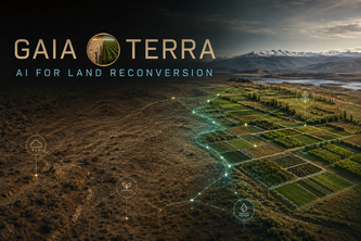
What the company appears to be: GAIA Terra is a self-reported concept and demonstration project built for the OpenAI 2026 hackathon. The author describes it as an AI-powered decision-support tool that helps users assess degraded or underused land by analyzing environmental and geographic data, then proposing possible agricultural recovery paths and pilot plans.
What changed: This is a prototype submitted to a hackathon; there is no evidence of prior development, funding, or commercial traction. It is described as a demonstration of an idea, not a product in use.
The single most important open question: Is there any evidence that the system has been validated with real agronomic data or field measurements? The description states that future development would require such validation — but does it currently exist?
What The Product Actually Is
The description states that GAIA Terra is an intelligent decision-support concept designed to study unproductive land and explore recovery opportunities. It guides users through four main stages:
- Land profile
- Data passport
- Intelligent analysis
- Pilot plan
It is described as a functional demonstration with an interactive flow that allows users to enter data about location, soil, climate, slope, water availability, access, restrictions, investment, and time horizon.
The system then analyzes these inputs to identify possible agricultural opportunities adapted to the terrain, comparing alternatives based on potential, cost, risk, and development time.
It is presented as a concept and demonstration, not a deployed product or service.
Evidence: The author describes the tool's functionality in detail but does not provide evidence of actual use, data integration, or operational systems beyond the prototype stage.
Positioning & Claim Evolution
The description states that GAIA Terra was inspired by the question: “What if unused land could live again?” It positions itself as a tool that explores what land could become, rather than what it produces today.
It claims to help users understand the potential of terrain before making important investments, and emphasizes that it does not promise instant success but offers a structured starting point for recovery planning.
The author also states that GAIA Terra was created for land that was “left behind,” aiming to restore soil not just for production but for understanding what is still possible.
Inference: The positioning suggests a mission-driven, sustainability-focused approach, likely targeting environmentalists, farmers, or policymakers interested in land restoration. However, this is a self-stated claim without evidence of adoption or impact.
Target Customer & ICP
The description does not name specific customer segments or personas. It implies the tool could be used by:
- Individuals or organizations assessing unproductive land
- Farmers or agronomists planning recovery projects
- Policymakers or NGOs working on land restoration initiatives
It is described as a tool for anyone who wants to understand the potential of a terrain before investing, suggesting broad applicability.
Evidence: No explicit customer profiles, user types, or ICPs are provided. The description focuses on the concept and prototype rather than target users.
Business Model & Pricing Evidence
There is no evidence in the description of a business model or pricing structure. The project is described as a concept and demonstration, not a commercial offering.
The author notes that future development would require validated data sources, agronomic models, field measurements, and collaboration with specialists — but does not indicate whether such a model exists or how it might be monetized.
Evidence: Not evidenced.
Technical & Delivery Signals
The project was built using technologies including:
- Artificial intelligence (AI)
- OpenAI tools
- Web interface
- Data analysis and visualization
It is described as a functional demonstration with an interactive flow, suggesting some level of technical implementation. However, there is no mention of backend systems, data pipelines, or scalability beyond the prototype.
The author states that it was built for a hackathon — implying limited time and resources were available for development.
Evidence: The tool exists as a prototype but lacks evidence of production-grade infrastructure or delivery mechanisms.
Traction & Maturity Signals
There is no evidence of traction, revenue, customers, or adoption. The project is described as:
- A concept
- A demonstration
- Built for a hackathon
- Not yet validated with real-world data or field measurements
The author explicitly states that the future development would require “validated data sources, agronomic models, field measurements, and collaboration with agricultural and environmental specialists.”
Evidence: Not evidenced.
Competitive Context
There is no evidence of existing competitors or market positioning in the description. The project is presented as a novel idea for land recovery using AI, but no mention is made of similar tools or platforms in the agriculture or environmental sectors.
The author does not reference any competitive landscape or prior art.
Evidence: Not evidenced.
Open Questions & Risks
- Unvalidated assumptions: The system relies on data inputs and models that are not described as validated or tested.
- Prototype only: No evidence of a functioning product, real users, or operational systems.
- No commercialization path: No indication of how the idea might evolve into a sustainable business.
- Limited scope: The project is presented as a demonstration for a hackathon — not a scalable solution.
- Lack of data sources: The description notes that future development would require validated data, implying current lack of such inputs.
Inference: Without real-world validation or traction, the risk of failure in moving from prototype to product is high.
Questions the description leaves open
- What specific agronomic or environmental data sources are being used or planned for integration?
- Has the AI model been tested with real field data or simulations?
- Are there any partnerships or collaborations with agricultural or environmental experts already in place?
- What is the plan to move from a prototype to a scalable, production-ready system?
- How would you monetize this concept if it were to become a product?
Overall Assessment
This project is described as a self-reported hackathon submission and a conceptual demonstration, not a commercial product or service.
There is no evidence of revenue, customers, traction, or validated data. The description indicates that future development would require significant validation and collaboration — but none is currently evident.
Confidence level: Low. This is a very early-stage idea with no demonstrated market fit, product-market traction, or business model.
Assessment: Not ready for investment or partnership at this stage. It may be of interest as a proof-of-concept or early-stage idea, but lacks the evidence to support further diligence or commitment.
User Stories BotA demo video on every pull request
Get a demo video on every new feature
GitHub App that watches your pull requests and records a narrated, captioned demo.
Save time on demo prep and make informed decisions faster with a video walkthrough of every new feature.
Source
Submitted to the OpenAI 2026 hackathon on Devpost. Project home on Devpost. Back to the full gallery on Devpost.
This competitive analysis was produced by top-founders.com (opens in a new tab)
Generated by a language model from this project's public Devpost page — its tagline, the author's own write-up and any built-with tags listed there — as captured in August 2026. Short quotations are the author's words. It is an opinion on the idea as a business, not on the people behind it, and it reflects the description as published then. If the project has moved on, request a correction below. The analysis is not independent research and contains no verified traction, revenue or customer data.
An independent guide by KFG International LLC — not affiliated with, endorsed by, or connected to Devpost or OpenAI.