

Archive position — measured, not model output
1 like on Devpost
505 of the 7,850 archived projects have more likes, and 1,758 share exactly 1 — so this project's #510 place in the like-ranked listing is a tie-break inside that group, not a ranking.
Projects (log scale)
Likes on Devpost. ▲ marks this project's group.
Show the figures
| Likes | Projects | Share of archive |
|---|---|---|
| 0 | 5,587 | 71.2% |
| 1 | 1,758 | 22.4% |
| 2 | 284 | 3.6% |
| 3–4 | 132 | 1.7% |
| 5–9 | 75 | 1.0% |
| 10+ | 14 | 0.2% |
 User Stories BotA demo video on every pull request
Get a demo video on every new feature
GitHub App that watches your pull requests and records a narrated, captioned demo.
Save time on demo prep and make informed decisions faster with a video walkthrough of every new feature.
Executive Summary
What the company appears to be
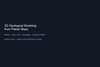
The project described by the caller is a self-reported open-source prototype for converting 2D geological maps into 3D geological models using Python-based tools like Gradio, OpenCV, GemPy, and PyVista. It was built as part of an innovation project submitted to the OpenAI 2026 hackathon.
What changed
The author states that this is a working pipeline from planar map data to interactive 3D visualization, using a modular approach with extraction and modeling stages. The system currently uses synthetic inputs for demonstration but aims to integrate real-world map data via CSV schema alignment.
Single most important open question — the commercial due-diligence read
Is there evidence of traction or adoption beyond the author's own development efforts? There is no indication that this project has moved beyond a prototype stage, nor any evidence of revenue, customers, or usage by external parties.
Note: This analysis is based entirely on self-reported information from the project description provided. No third-party verification or historical data are available. All claims are attributed to the author’s own account and should be treated as unverified.
What The Product Actually Is
The description states that this is a prototype pipeline for converting 2D geological maps into 3D models using open-source tools. It consists of two main stages:
- Map information extraction (Stage A) – A Gradio-based tool that processes scanned color maps using techniques such as:
- MeanShift smoothing
- Black-line masking
- LAB color clustering (KMeans / Auto-K)
- Contour extraction and CSV export
- 3D modeling (Stage B) – Uses GemPy for implicit modeling, PyVista for visualization, and outputs an interactive HTML model.
The system currently uses synthetic data to demonstrate functionality but is designed to eventually accept real map inputs via a shared CSV schema.
Inference: The product is not yet fully automated or production-ready. It is described as a proof-of-concept with clear technical architecture but no commercial deployment or user base.
Positioning & Claim Evolution
The author claims that the goal was to make 3D geological modeling accessible without expensive software, especially for students and small teams who rely on historical paper or scanned maps.
They state:
- The project started from a university innovation initiative.
- It aims to democratize access to 3D geology tools.
- They emphasize open-source and reproducibility over proprietary solutions.
There is no evidence of prior positioning or evolution in the market; this appears to be a new effort with no prior product history or branding.
Claim: The project positions itself as an open, accessible alternative to commercial software like GOCAD or Leapfrog.
Inference: This is a self-positioning statement, not validated by external adoption or market feedback.
Target Customer & ICP
The description states that the target users are:
- Geology students
- Small research teams
- Educators teaching field courses
It also mentions:
- The need to unlock archives of historical maps
- A desire to avoid reliance on expensive commercial tools
However, there is no evidence of specific customer segments, personas, or user interviews.
Claim: The intended audience includes academic and educational users.
Inference: No data on actual usage patterns, customer feedback, or segmentation beyond general categories.
Business Model & Pricing Evidence
There is no mention of any pricing model, monetization strategy, or business model in the description. The project is presented as an open-source tool with no indication of paid services or products.
Not evidenced: No evidence of revenue streams, pricing plans, or commercialization efforts.
Technical & Delivery Signals
The author describes:
- Use of Python-based libraries: OpenCV, scikit-learn, Gradio, GemPy, PyVista
- Modular architecture with separate pipelines for extraction and modeling
- Synthetic data used to validate the 3D modeling pipeline before integrating real-world inputs
- Clear CSV schema alignment between stages
They also note:
- Challenges in map quality (e.g., B&W maps, noise)
- Dependency issues with GemPy APIs and HTML export
- A deliberate choice to build a backend-first MVP before perfecting frontend extraction
Inference: The technical stack is well-defined for prototype development but lacks scalability or production-grade delivery signals.
Traction & Maturity Signals
The project is described as:
- A working prototype
- Submitted to a hackathon (OpenAI 2026)
- Built by one individual (yiyi zhang)
There is no evidence of:
- Customers or users
- Revenue or monetization
- Product adoption or usage metrics
- Any form of traction beyond the author's own development
Not evidenced: No signs of market traction, user engagement, or commercial viability.
Competitive Context
The description mentions:
- Commercial tools like GOCAD and Leapfrog
- Related open-source projects such as DIGMAPPER, map2loop, MapSAM/samgeo, SE-UNet, etc.
- Literature review (~100 papers) on map-to-loop conversion methods
It does not provide any competitive analysis or differentiation from existing tools.
Inference: The project is positioned in a niche space where open-source alternatives may be underdeveloped or lacking in usability.
Open Questions & Risks
Key risks identified based on the description:
- Prototype-only status: No evidence of product-market fit, traction, or commercial viability.
- Dependency on manual steps: Extraction still requires human-in-the-loop corrections and is not fully automated.
- Limited scalability: The system uses synthetic data for now; real-world integration remains a challenge.
- No monetization path: No indication of how the project will generate revenue or sustain itself.
- Single-person team: Limited capacity to scale or iterate quickly.
Open question: Lack of any commercial or user-facing activity suggests low probability of near-term market impact.
Questions the description leaves open
- What is your plan for transitioning from synthetic data to real-world map inputs?
- Have you tested the system with actual geological datasets from institutions or field teams?
- Are there any plans to commercialize this tool or offer it as a service?
- How do you intend to address dependency friction and API limitations in GemPy?
- What is your roadmap for georeferencing, attitude-symbol recognition, and fault-trace modules?
- Do you have any feedback from educators or students who might use this tool?
Overall Assessment
This project is currently a research prototype with limited evidence of traction, adoption, or commercialization.
Assessment: Not ready for investment or partnership at this stage. It lacks key signals of product-market fit, user engagement, and monetization potential. The project shows promise in solving a specific technical problem but has not demonstrated any meaningful path to market success.
Confidence level: Low — based on sparse self-reported evidence with no external validation or metrics.
User Stories BotA demo video on every pull request
Get a demo video on every new feature
GitHub App that watches your pull requests and records a narrated, captioned demo.
Save time on demo prep and make informed decisions faster with a video walkthrough of every new feature.
Source
Submitted to the OpenAI 2026 hackathon on Devpost. Project home on Devpost. Back to the full gallery on Devpost.
This competitive analysis was produced by top-founders.com (opens in a new tab)
Generated by a language model from this project's public Devpost page — its tagline, the author's own write-up and any built-with tags listed there — as captured in August 2026. Short quotations are the author's words. It is an opinion on the idea as a business, not on the people behind it, and it reflects the description as published then. If the project has moved on, request a correction below. The analysis is not independent research and contains no verified traction, revenue or customer data.
An independent guide by KFG International LLC — not affiliated with, endorsed by, or connected to Devpost or OpenAI.